 EUR (€)
 USD ($)

 Dutch
Dutch  French
  German
  Spanish


-
![ADMIRALTY Chart - 18 Falmouth Inner Harbour including Penryn]() QtyAdd to Cart
QtyAdd to Cart -
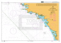
![ADMIRALTY Chart - 20 Ile D'Ouessant to Pointe de la Coubre]() QtyAdd to Cart
QtyAdd to Cart -
![Imray Chart - C1 Thames Estuary]() QtyAdd to Cart
QtyAdd to Cart -
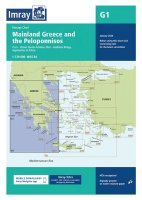
![Imray Chart - G1 Mainland Greece and the Peloponnisos]() QtyAdd to Cart
QtyAdd to Cart -
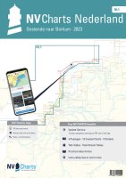
![NV Chart Atlas - NL1 Netherlands - Borkum naar Oostende]() QtyAdd to Cart
QtyAdd to Cart -
![Greenland Chart - G Greenland with Surrounding Waters]() QtyAdd to Cart
QtyAdd to Cart -
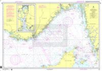
![Norway Chart - 305 Skaggerak]() QtyAdd to Cart
QtyAdd to Cart -
![Icelandic Chart - 21 Ísland]() QtyAdd to Cart
QtyAdd to Cart -
![UK, Ireland & Holland]() QtyAdd to Cart
QtyAdd to Cart -
![ADMIRALTY Tidal Stream Atlas - NP209 Orkney and Shetland Islands]() QtyAdd to Cart
QtyAdd to Cart -
![ADMIRALTY Sailing Directions - NP1 Africa Pilot Vol.1]() QtyAdd to Cart
QtyAdd to Cart -
![ADMIRALTY List of Lights and Fog Signals - NP80 Western Side of South Atlantic Ocean and East Pacific Ocean Vol. G]() QtyAdd to Cart
QtyAdd to Cart